
- Start >
- Rivers >
- Waterlevel >
- Naab - Regen >
- Eixendorf Speicherabfluss >
- Chart of year

Chart of year Eixendorf Speicherabfluss / Schwarzach
Waterlevel from 14.08.2021 to 13.08.2022
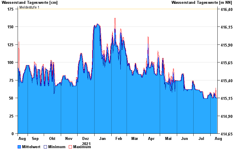
- Meldestufe 1 175 cm
- Meldestufe 2 190 cm
- Hochwassergefahrenfläche HQ100 220 cm
| Date | Mean value [cm] | Maximum [cm] | Minimum [cm] |
|---|---|---|---|
| 13.08.2022 | 50 | 50 | 50 |
| 12.08.2022 | 50 | 51 | 50 |
| 11.08.2022 | 51 | 64 | 50 |
| 10.08.2022 | 51 | 53 | 50 |
| 09.08.2022 | 54 | 56 | 52 |
| 08.08.2022 | 57 | 57 | 56 |
| 07.08.2022 | 54 | 58 | 50 |
© Bayerisches Landesamt für Umwelt 2024