
- Start >
- Rivers >
- Waterlevel >
- Naab - Regen >
- Eixendorf Speicherabfluss >
- Chart of month

Chart of month Eixendorf Speicherabfluss / Schwarzach
Waterlevel from 01.05.2024 to 01.05.2024
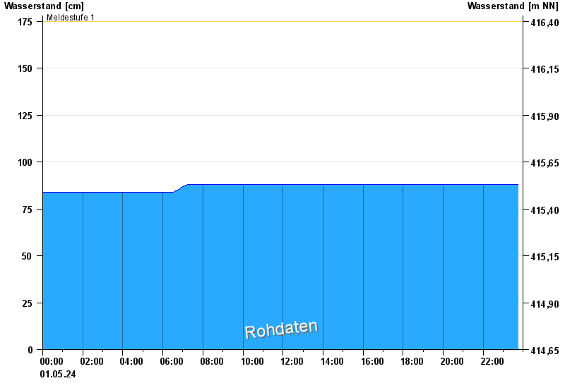
- Meldestufe 1 175 cm
- Meldestufe 2 190 cm
- Hochwassergefahrenfläche HQ100 220 cm
| Date | Waterlevel [cm] |
|---|---|
| 01.05.2024 15:15 | 88 |
| 01.05.2024 15:00 | 88 |
| 01.05.2024 14:45 | 88 |
| 01.05.2024 14:30 | 88 |
| 01.05.2024 14:15 | 88 |
| 01.05.2024 14:00 | 88 |
| 01.05.2024 13:45 | 88 |
© Bayerisches Landesamt für Umwelt 2024