
- Start >
- Rivers >
- Waterlevel >
- Naab - Regen >
- Donauwörth >
- Current values

Current values Donauwörth / Donau
Waterlevel from 12.04.2021 to 19.04.2021
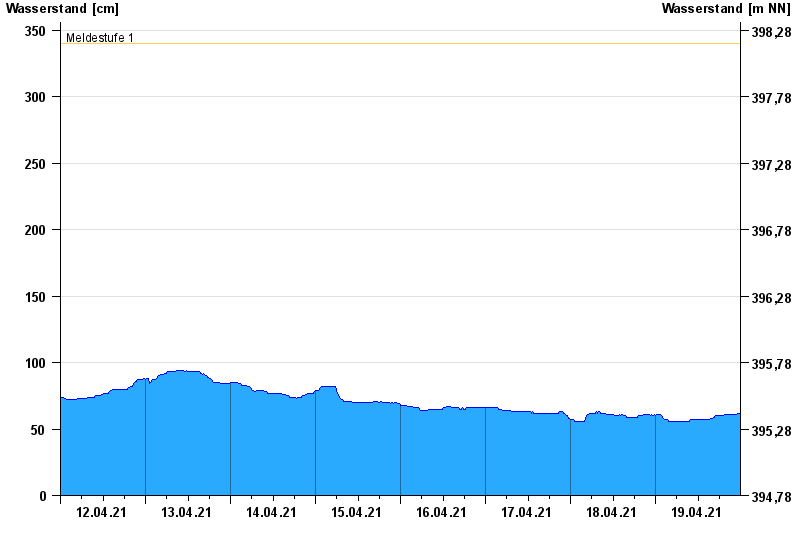
- Meldestufe 1 340 cm
- Meldestufe 2 460 cm
- Meldestufe 3 500 cm
- Meldestufe 4 540 cm
- Hochwassergefahrenfläche HQ100 580 cm
| Date | Waterlevel [cm] |
|---|---|
| 20.04.2021 00:45 | 60 |
| 20.04.2021 00:30 | 60 |
| 20.04.2021 00:15 | 61 |
| 20.04.2021 00:00 | 61 |
| 19.04.2021 23:45 | 62 |
| 19.04.2021 23:30 | 62 |
| 19.04.2021 23:15 | 62 |
© Bayerisches Landesamt für Umwelt 2024