
- Start >
- Rivers >
- Waterlevel >
- Unterer Main >
- Würzburg >
- Chart of month

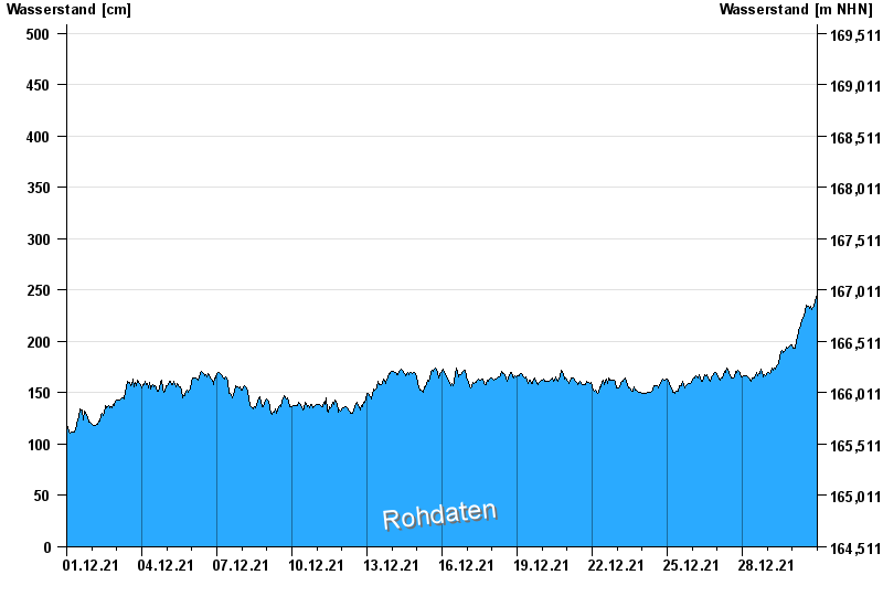
Chart of month Würzburg / Main
Waterlevel from 01.12.2021 to 30.12.2021
- 25.02.1970 Wasserstand: 669 cm
- 06.01.2003 Wasserstand: 648 cm
- 17.01.2011 Wasserstand: 642 cm
- 29.03.1988 Wasserstand: 640 cm
- 08.01.1982 Wasserstand: 639 cm
| Date | Waterlevel [cm] |
|---|---|
| 30.12.2021 23:45 | 245 |
| 30.12.2021 23:30 | 245 |
| 30.12.2021 23:15 | 243 |
| 30.12.2021 23:00 | 242 |
| 30.12.2021 22:45 | 241 |
| 30.12.2021 22:30 | 240 |
| 30.12.2021 22:15 | 239 |
© Bayerisches Landesamt für Umwelt 2024