
- Start >
- Rivers >
- Waterlevel >
- Unterer Main >
- Wolfsmünster >
- Chart of year

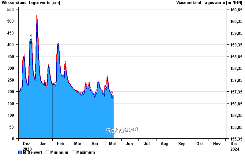
Chart of year Wolfsmünster / Fränkische Saale
Waterlevel from 03.12.2023 to 02.12.2024
- 03.01.2003 Wasserstand: 653 cm
- 14.01.2011 Wasserstand: 614 cm
- 24.01.1995 Wasserstand: 585 cm
- 08.02.1984 Wasserstand: 579 cm
- 06.01.1982 Wasserstand: 575 cm
| Date | Mean value [cm] | Maximum [cm] | Minimum [cm] |
|---|---|---|---|
| 04.05.2024 | 219 | 220 | 218 |
| 03.05.2024 | 230 | 245 | 205 |
| 02.05.2024 | 189 | 204 | 179 |
| 01.05.2024 | 190 | 194 | 186 |
| 30.04.2024 | 193 | 198 | 187 |
| 29.04.2024 | 196 | 205 | 186 |
| 28.04.2024 | 201 | 203 | 198 |
© Bayerisches Landesamt für Umwelt 2024