
- Start >
- Rivers >
- Waterlevel >
- Unterer Main >
- Wolfsmünster >
- Chart of year

Chart of year Wolfsmünster / Fränkische Saale
Waterlevel from 18.01.2022 to 17.01.2023
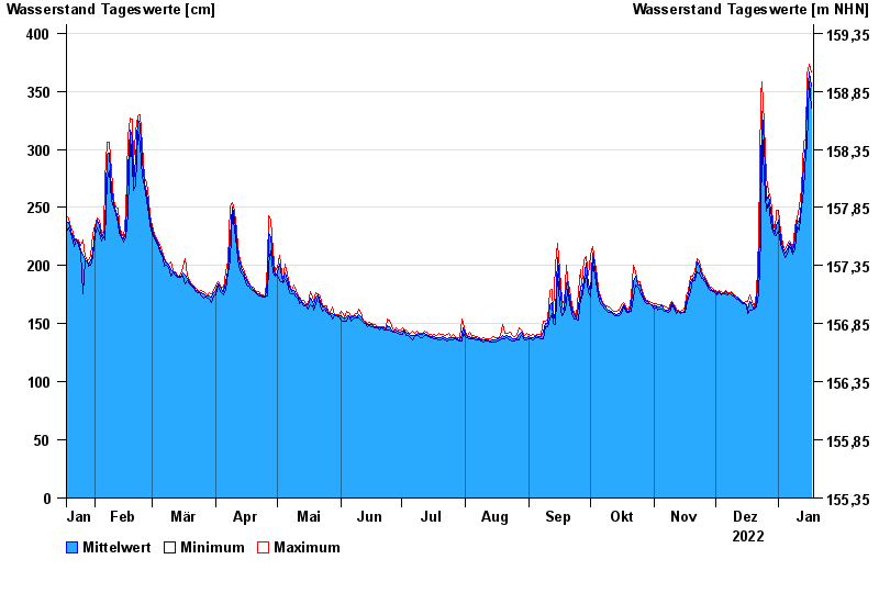
| Date | Mean value [cm] | Maximum [cm] | Minimum [cm] |
|---|---|---|---|
| 17.01.2023 | 354 | 367 | 335 |
| 16.01.2023 | 367 | 373 | 358 |
| 15.01.2023 | 346 | 365 | 302 |
| 14.01.2023 | 304 | 308 | 298 |
| 13.01.2023 | 288 | 307 | 266 |
| 12.01.2023 | 254 | 266 | 249 |
| 11.01.2023 | 237 | 250 | 231 |
© Bayerisches Landesamt für Umwelt 2024