
- Start >
- Rivers >
- Waterlevel >
- Unterer Main >
- Wolfsmünster >
- Chart of year

Chart of year Wolfsmünster / Fränkische Saale
Waterlevel from 23.01.2022 to 22.01.2023
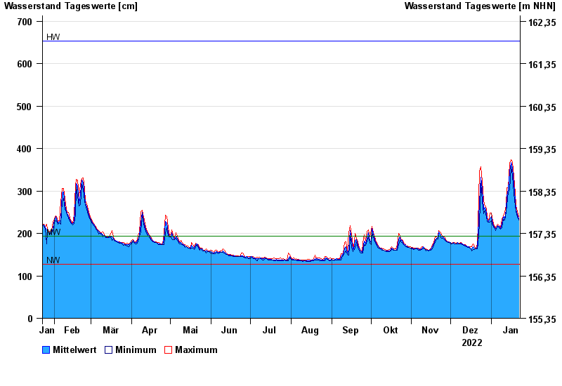
| Date | Mean value [cm] | Maximum [cm] | Minimum [cm] |
|---|---|---|---|
| 22.01.2023 | 234 | 239 | 231 |
| 21.01.2023 | 244 | 251 | 239 |
| 20.01.2023 | 257 | 265 | 251 |
| 19.01.2023 | 278 | 295 | 265 |
| 18.01.2023 | 318 | 335 | 295 |
| 17.01.2023 | 354 | 367 | 335 |
| 16.01.2023 | 367 | 373 | 358 |
© Bayerisches Landesamt für Umwelt 2024