
- Start >
- Rivers >
- Waterlevel >
- Unterer Main >
- Wolfsmünster >
- Chart of year

Chart of year Wolfsmünster / Fränkische Saale
Waterlevel from 03.12.2023 to 02.12.2024
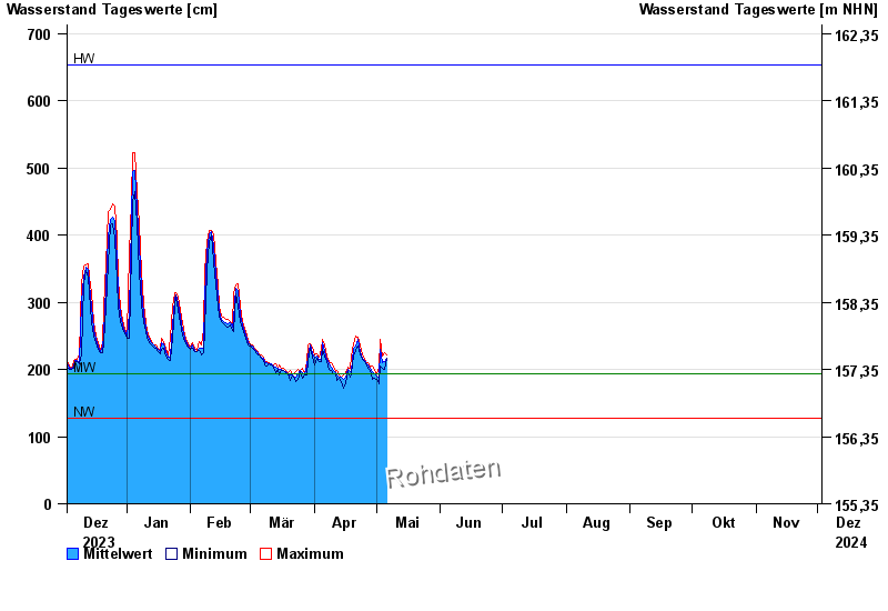
| Date | Mean value [cm] | Maximum [cm] | Minimum [cm] |
|---|---|---|---|
| 21.06.2024 | 166 | 167 | 165 |
| 20.06.2024 | 167 | 178 | 152 |
| 19.06.2024 | 169 | 180 | 165 |
| 18.06.2024 | 168 | 173 | 166 |
| 17.06.2024 | 168 | 172 | 167 |
| 16.06.2024 | 169 | 173 | 164 |
| 15.06.2024 | 168 | 178 | 162 |
© Bayerisches Landesamt für Umwelt 2024