
- Start >
- Rivers >
- Waterlevel >
- Unterer Main >
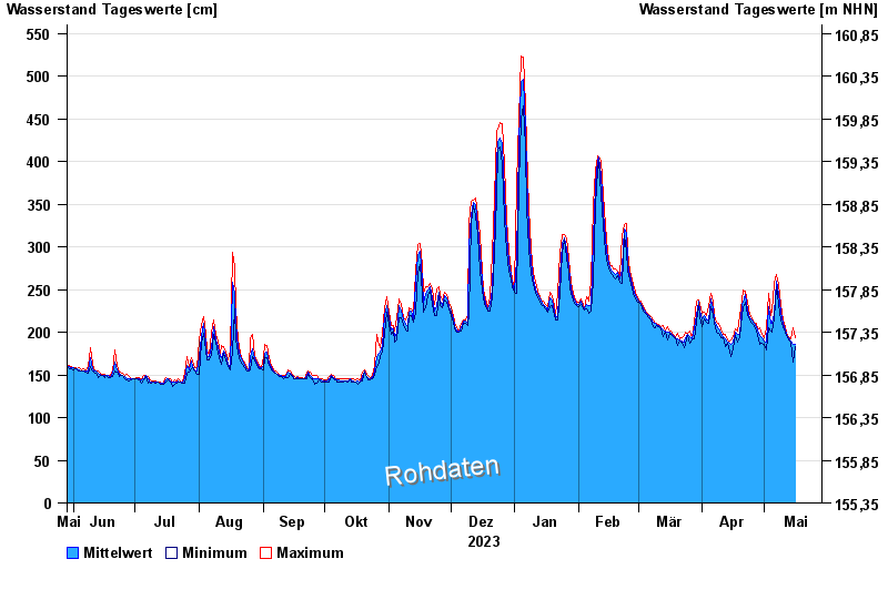
- Wolfsmünster >
- Chart of year

Chart of year Wolfsmünster / Fränkische Saale
Waterlevel from 29.05.2023 to 28.05.2024
- 03.01.2003 Wasserstand: 653 cm
- 14.01.2011 Wasserstand: 614 cm
- 24.01.1995 Wasserstand: 585 cm
- 08.02.1984 Wasserstand: 579 cm
- 06.01.1982 Wasserstand: 575 cm
| Date | Mean value [cm] | Maximum [cm] | Minimum [cm] |
|---|---|---|---|
| 29.04.2024 | 196 | 205 | 186 |
| 28.04.2024 | 201 | 203 | 198 |
| 27.04.2024 | 206 | 210 | 201 |
| 26.04.2024 | 210 | 212 | 208 |
| 25.04.2024 | 214 | 216 | 211 |
| 24.04.2024 | 217 | 221 | 215 |
| 23.04.2024 | 226 | 235 | 221 |
© Bayerisches Landesamt für Umwelt 2024