
- Start >
- Rivers >
- Waterlevel >
- Unterer Main >
- Wolfsmünster >
- Chart of year

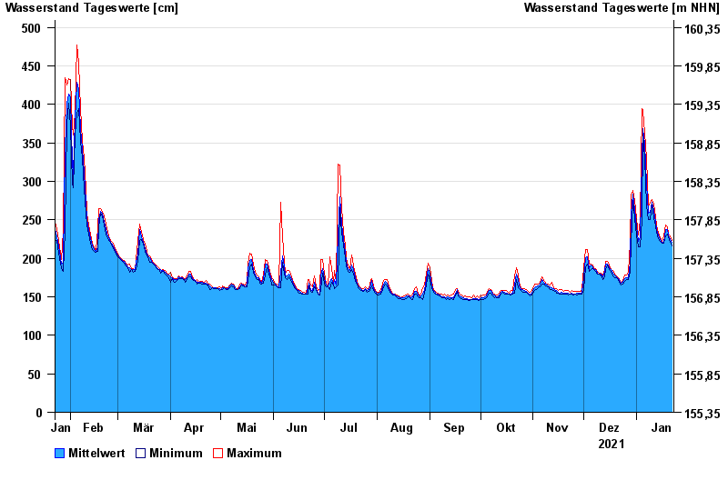
Chart of year Wolfsmünster / Fränkische Saale
Waterlevel from 23.01.2021 to 22.01.2022
- 03.01.2003 Wasserstand: 653 cm
- 14.01.2011 Wasserstand: 614 cm
- 24.01.1995 Wasserstand: 585 cm
- 08.02.1984 Wasserstand: 579 cm
- 06.01.1982 Wasserstand: 575 cm
| Date | Mean value [cm] | Maximum [cm] | Minimum [cm] |
|---|---|---|---|
| 22.01.2022 | 221 | 223 | 216 |
| 21.01.2022 | 225 | 229 | 221 |
| 20.01.2022 | 230 | 232 | 228 |
| 19.01.2022 | 237 | 241 | 232 |
| 18.01.2022 | 238 | 243 | 229 |
| 17.01.2022 | 221 | 229 | 220 |
| 16.01.2022 | 221 | 222 | 220 |
© Bayerisches Landesamt für Umwelt 2024