
- Start >
- Rivers >
- Waterlevel >
- Unterer Main >
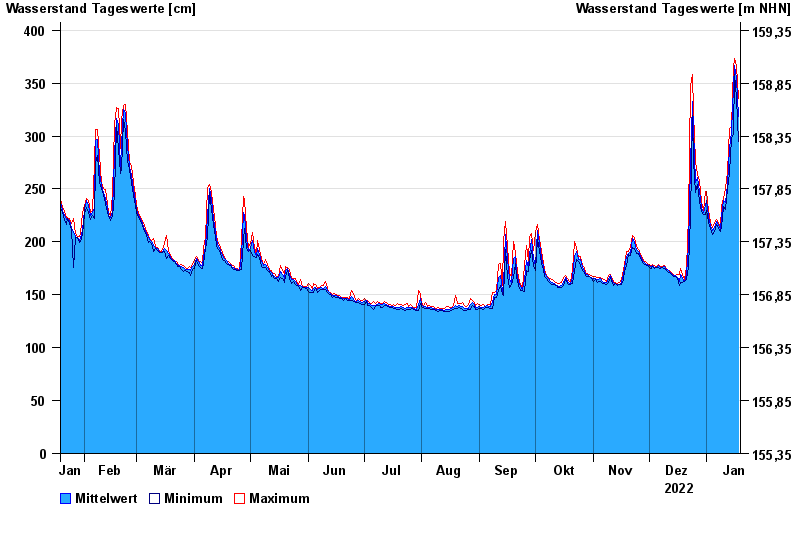
- Wolfsmünster >
- Chart of year

Chart of year Wolfsmünster / Fränkische Saale
Waterlevel from 19.01.2022 to 18.01.2023
- 03.01.2003 Wasserstand: 653 cm
- 14.01.2011 Wasserstand: 614 cm
- 24.01.1995 Wasserstand: 585 cm
- 08.02.1984 Wasserstand: 579 cm
- 06.01.1982 Wasserstand: 575 cm
| Date | Mean value [cm] | Maximum [cm] | Minimum [cm] |
|---|---|---|---|
| 18.01.2023 | 318 | 335 | 295 |
| 17.01.2023 | 354 | 367 | 335 |
| 16.01.2023 | 367 | 373 | 358 |
| 15.01.2023 | 346 | 365 | 302 |
| 14.01.2023 | 304 | 308 | 298 |
| 13.01.2023 | 288 | 307 | 266 |
| 12.01.2023 | 254 | 266 | 249 |
© Bayerisches Landesamt für Umwelt 2024