
- Start >
- Rivers >
- Waterlevel >
- Unterer Main >
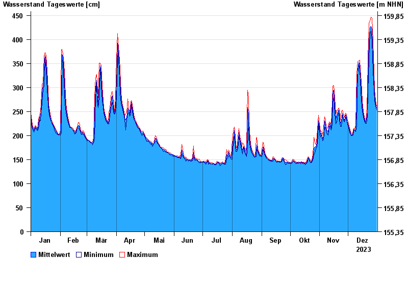
- Wolfsmünster >
- Chart of year

Chart of year Wolfsmünster / Fränkische Saale
Waterlevel from 01.01.2023 to 31.12.2023
- 03.01.2003 Wasserstand: 653 cm
- 14.01.2011 Wasserstand: 614 cm
- 24.01.1995 Wasserstand: 585 cm
- 08.02.1984 Wasserstand: 579 cm
- 06.01.1982 Wasserstand: 575 cm
| Date | Mean value [cm] | Maximum [cm] | Minimum [cm] |
|---|---|---|---|
| 31.12.2023 | 257 | 261 | 253 |
| 30.12.2023 | 266 | 273 | 261 |
| 29.12.2023 | 283 | 295 | 272 |
| 28.12.2023 | 313 | 333 | 295 |
| 27.12.2023 | 362 | 396 | 333 |
| 26.12.2023 | 421 | 444 | 396 |
| 25.12.2023 | 427 | 446 | 417 |
© Bayerisches Landesamt für Umwelt 2024