
- Start >
- Rivers >
- Waterlevel >
- Unterer Main >
- Wolfsmünster >
- Chart of year

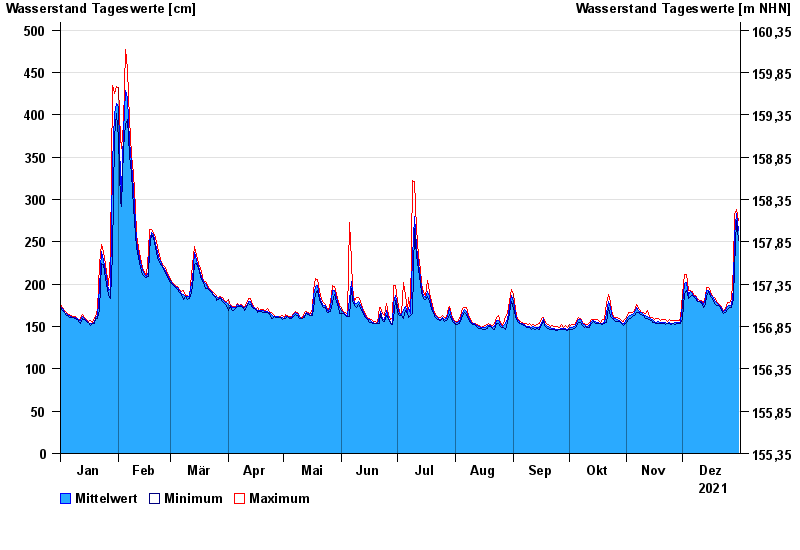
Chart of year Wolfsmünster / Fränkische Saale
Waterlevel from 01.01.2021 to 31.12.2021
- 03.01.2003 Wasserstand: 653 cm
- 14.01.2011 Wasserstand: 614 cm
- 24.01.1995 Wasserstand: 585 cm
- 08.02.1984 Wasserstand: 579 cm
- 06.01.1982 Wasserstand: 575 cm
| Date | Mean value [cm] | Maximum [cm] | Minimum [cm] |
|---|---|---|---|
| 31.12.2021 | 263 | 275 | 252 |
| 30.12.2021 | 283 | 288 | 275 |
| 29.12.2021 | 258 | 282 | 220 |
| 28.12.2021 | 195 | 220 | 182 |
| 27.12.2021 | 175 | 182 | 172 |
| 26.12.2021 | 175 | 178 | 172 |
| 25.12.2021 | 174 | 178 | 170 |
© Bayerisches Landesamt für Umwelt 2024