
- Start >
- Rivers >
- Waterlevel >
- Unterer Main >
- Wolfsmünster >
- Chart of month

Chart of month Wolfsmünster / Fränkische Saale
Waterlevel from 01.01.2023 to 31.01.2023
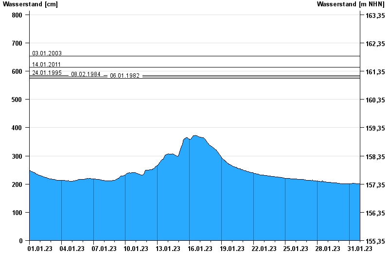
- 03.01.2003 Wasserstand: 653 cm
- 14.01.2011 Wasserstand: 614 cm
- 24.01.1995 Wasserstand: 585 cm
- 08.02.1984 Wasserstand: 579 cm
- 06.01.1982 Wasserstand: 575 cm
| Date | Waterlevel [cm] |
|---|---|
| 31.01.2023 23:45 | 202 |
| 31.01.2023 23:30 | 202 |
| 31.01.2023 23:15 | 202 |
| 31.01.2023 23:00 | 202 |
| 31.01.2023 22:45 | 202 |
| 31.01.2023 22:30 | 202 |
| 31.01.2023 22:15 | 202 |
© Bayerisches Landesamt für Umwelt 2024