
- Start >
- Rivers >
- Waterlevel >
- Unterer Main >
- Vorra >
- Chart of year

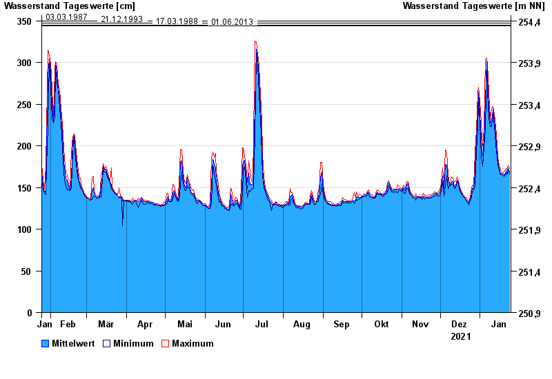
Chart of year Vorra / Rauhe Ebrach
Waterlevel from 25.01.2021 to 24.01.2022
- 26.01.1995 Wasserstand: 353 cm
- 03.03.1987 Wasserstand: 350 cm
- 21.12.1993 Wasserstand: 347 cm
- 17.03.1988 Wasserstand: 345 cm
- 01.06.2013 Wasserstand: 344 cm
| Date | Mean value [cm] | Maximum [cm] | Minimum [cm] |
|---|---|---|---|
| 24.01.2022 | 169 | 173 | 166 |
| 23.01.2022 | 174 | 177 | 171 |
| 22.01.2022 | 167 | 172 | 165 |
| 21.01.2022 | 170 | 173 | 167 |
| 20.01.2022 | 165 | 170 | 164 |
| 19.01.2022 | 165 | 167 | 164 |
| 18.01.2022 | 167 | 169 | 165 |
© Bayerisches Landesamt für Umwelt 2024