
- Start >
- Rivers >
- Waterlevel >
- Unterer Main >
- Vorra >
- Chart of year

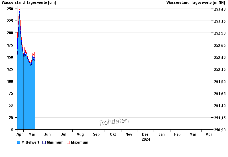
Chart of year Vorra / Rauhe Ebrach
Waterlevel from 19.04.2024 to 18.04.2025
- 26.01.1995 Wasserstand: 353 cm
- 03.03.1987 Wasserstand: 350 cm
- 21.12.1993 Wasserstand: 347 cm
- 17.03.1988 Wasserstand: 345 cm
- 01.06.2013 Wasserstand: 344 cm
| Date | Mean value [cm] | Maximum [cm] | Minimum [cm] |
|---|---|---|---|
| 21.05.2024 | 143 | 149 | 141 |
| 20.05.2024 | 151 | 158 | 145 |
| 19.05.2024 | 147 | 152 | 144 |
| 18.05.2024 | 151 | 153 | 149 |
| 17.05.2024 | 149 | 160 | 138 |
| 16.05.2024 | 136 | 138 | 134 |
| 15.05.2024 | 135 | 136 | 134 |
© Bayerisches Landesamt für Umwelt 2024