
- Start >
- Rivers >
- Waterlevel >
- Unterer Main >
- Vorra >
- Chart of month

Chart of month Vorra / Rauhe Ebrach
Waterlevel from 27.01.2021 to 26.02.2021
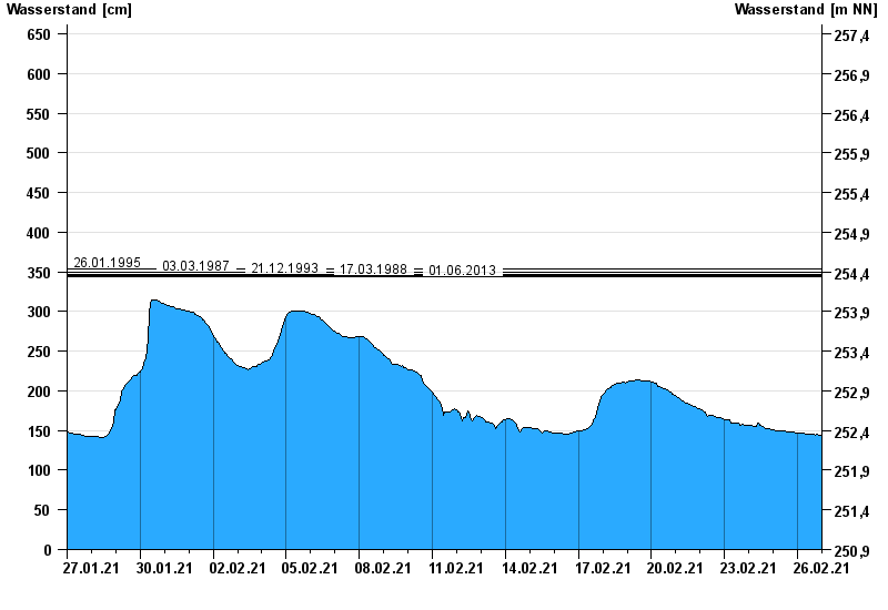
- 26.01.1995 Wasserstand: 353 cm
- 03.03.1987 Wasserstand: 350 cm
- 21.12.1993 Wasserstand: 347 cm
- 17.03.1988 Wasserstand: 345 cm
- 01.06.2013 Wasserstand: 344 cm
| Date | Waterlevel [cm] |
|---|---|
| 26.02.2021 23:45 | 144 |
| 26.02.2021 23:30 | 144 |
| 26.02.2021 23:15 | 144 |
| 26.02.2021 23:00 | 144 |
| 26.02.2021 22:45 | 144 |
| 26.02.2021 22:30 | 144 |
| 26.02.2021 22:15 | 144 |
© Bayerisches Landesamt für Umwelt 2024