
- Start >
- Rivers >
- Waterlevel >
- Unterer Main >
- Untermerzbach >
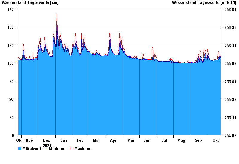
- Chart of year

Chart of year Untermerzbach / Merzbach
Waterlevel from 26.10.2021 to 25.10.2022
| Date | Mean value [cm] | Maximum [cm] | Minimum [cm] |
|---|---|---|---|
| 25.10.2022 | 108 | 109 | 107 |
| 24.10.2022 | 110 | 112 | 107 |
| 23.10.2022 | 107 | 108 | 106 |
| 22.10.2022 | 109 | 112 | 108 |
| 21.10.2022 | 108 | 116 | 104 |
| 20.10.2022 | 104 | 112 | 104 |
| 19.10.2022 | 104 | 104 | 104 |
© Bayerisches Landesamt für Umwelt 2024