
- Start >
- Rivers >
- Waterlevel >
- Unterer Main >
- Schöllkrippen >
- Chart of month

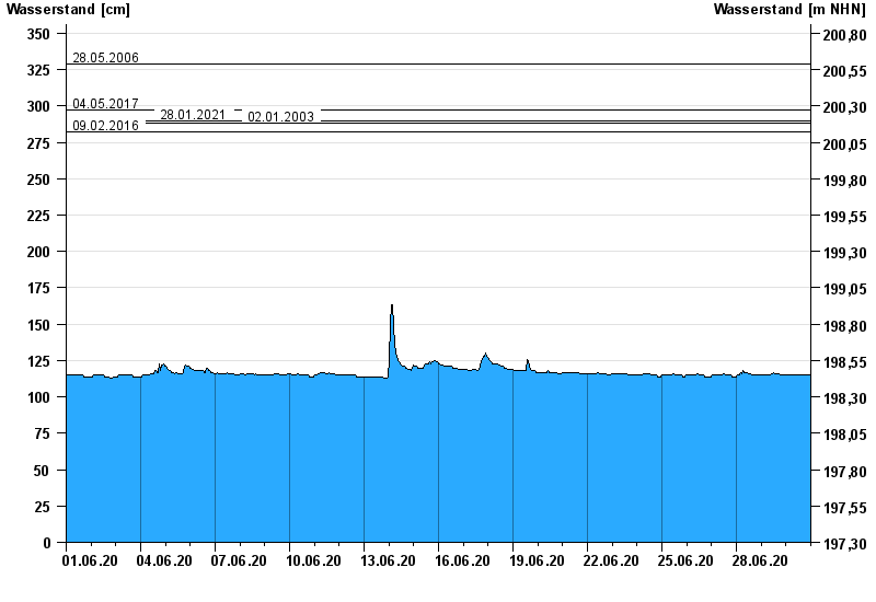
Chart of month Schöllkrippen / Kahl
Waterlevel from 01.06.2020 to 30.06.2020
note
Neue Meldestufen 1 (190 cm) und Meldestufe 2 (220 cm)
- 28.05.2006 Wasserstand: 329 cm
- 04.05.2017 Wasserstand: 297 cm
- 28.01.2021 Wasserstand: 290 cm
- 02.01.2003 Wasserstand: 288 cm
- 09.02.2016 Wasserstand: 282 cm
| Date | Waterlevel [cm] |
|---|---|
| 01.07.2020 00:45 | 115 |
| 01.07.2020 00:30 | 115 |
| 01.07.2020 00:15 | 115 |
| 01.07.2020 00:00 | 115 |
| 30.06.2020 23:45 | 115 |
| 30.06.2020 23:30 | 115 |
| 30.06.2020 23:15 | 115 |
© Bayerisches Landesamt für Umwelt 2024