
- Start >
- Rivers >
- Waterlevel >
- Unterer Main >
- Scheinfeld >
- Chart of year

Chart of year Scheinfeld / Scheine
Waterlevel from 23.05.2020 to 22.05.2021
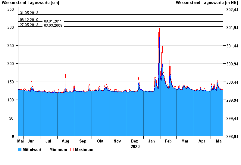
- 31.05.2013 Wasserstand: 335 cm
- 08.12.2010 Wasserstand: 316 cm
- 08.01.2011 Wasserstand: 312 cm
- 27.05.2013 Wasserstand: 302 cm
- 03.03.2008 Wasserstand: 300 cm
| Date | Mean value [cm] | Maximum [cm] | Minimum [cm] |
|---|---|---|---|
| 22.05.2021 | 127 | 128 | 127 |
| 21.05.2021 | 127 | 128 | 127 |
| 20.05.2021 | 128 | 129 | 128 |
| 19.05.2021 | 128 | 130 | 127 |
| 18.05.2021 | 129 | 130 | 128 |
| 17.05.2021 | 131 | 133 | 130 |
| 16.05.2021 | 131 | 133 | 131 |
© Bayerisches Landesamt für Umwelt 2024