
- Start >
- Rivers >
- Waterlevel >
- Unterer Main >
- Salz >
- Chart of year

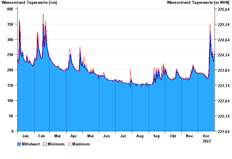
Chart of year Salz / Fränkische Saale
Waterlevel from 01.01.2022 to 31.12.2022
- 03.01.2003 Wasserstand: 488 cm
- 14.01.2011 Wasserstand: 470 cm
- 06.01.1982 Wasserstand: 466 cm
- 23.01.1995 Wasserstand: 465 cm
- 07.02.1984 Wasserstand: 463 cm
| Date | Mean value [cm] | Maximum [cm] | Minimum [cm] |
|---|---|---|---|
| 31.12.2022 | 252 | 259 | 241 |
| 30.12.2022 | 230 | 241 | 226 |
| 29.12.2022 | 234 | 237 | 233 |
| 28.12.2022 | 242 | 253 | 235 |
| 27.12.2022 | 262 | 270 | 253 |
| 26.12.2022 | 249 | 269 | 242 |
| 25.12.2022 | 271 | 297 | 252 |
© Bayerisches Landesamt für Umwelt 2024