
- Start >
- Rivers >
- Waterlevel >
- Unterer Main >
- Salz >
- Chart of year

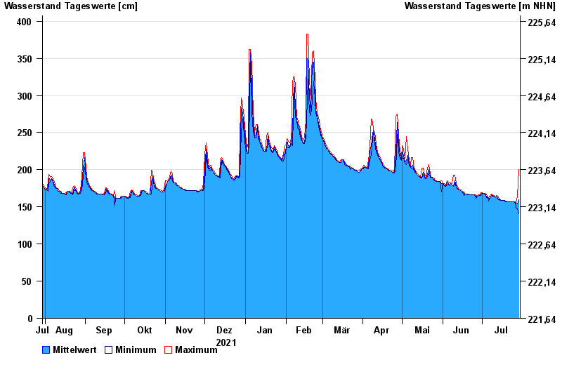
Chart of year Salz / Fränkische Saale
Waterlevel from 30.07.2021 to 29.07.2022
- 03.01.2003 Wasserstand: 488 cm
- 14.01.2011 Wasserstand: 470 cm
- 06.01.1982 Wasserstand: 466 cm
- 23.01.1995 Wasserstand: 465 cm
- 07.02.1984 Wasserstand: 463 cm
| Date | Mean value [cm] | Maximum [cm] | Minimum [cm] |
|---|---|---|---|
| 29.07.2022 | 160 | 200 | 141 |
| 28.07.2022 | 154 | 164 | 147 |
| 27.07.2022 | 154 | 156 | 148 |
| 26.07.2022 | 156 | 157 | 156 |
| 25.07.2022 | 157 | 157 | 157 |
| 24.07.2022 | 157 | 157 | 157 |
| 23.07.2022 | 157 | 157 | 157 |
© Bayerisches Landesamt für Umwelt 2024