
- Start >
- Rivers >
- Waterlevel >
- Unterer Main >
- Sachsenheim >
- Chart of year

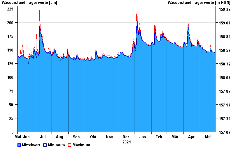
Chart of year Sachsenheim / Wern
Waterlevel from 30.05.2021 to 29.05.2022
- 26.01.1995 Wasserstand: 340 cm
- 03.01.2003 Wasserstand: 336 cm
- 06.01.1982 Wasserstand: 330 cm
- 08.01.2011 Wasserstand: 327 cm
- 31.01.1982 Wasserstand: 316 cm
| Date | Mean value [cm] | Maximum [cm] | Minimum [cm] |
|---|---|---|---|
| 29.05.2022 | 144 | 145 | 142 |
| 28.05.2022 | 145 | 146 | 145 |
| 27.05.2022 | 144 | 146 | 144 |
| 26.05.2022 | 144 | 145 | 144 |
| 25.05.2022 | 145 | 146 | 145 |
| 24.05.2022 | 146 | 147 | 146 |
| 23.05.2022 | 147 | 148 | 146 |
© Bayerisches Landesamt für Umwelt 2024