
- Start >
- Rivers >
- Waterlevel >
- Unterer Main >
- Römershofen >
- Chart of year

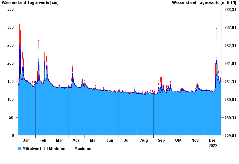
Chart of year Römershofen / Nassach
Waterlevel from 01.01.2022 to 31.12.2022
- 08.12.1981 Wasserstand: 380 cm
- 23.01.1995 Wasserstand: 376 cm
- 03.01.2003 Wasserstand: 370 cm
- 22.04.1989 Wasserstand: 370 cm
- 07.02.1984 Wasserstand: 365 cm
| Date | Mean value [cm] | Maximum [cm] | Minimum [cm] |
|---|---|---|---|
| 31.12.2022 | 158 | 162 | 154 |
| 30.12.2022 | 147 | 154 | 145 |
| 29.12.2022 | 145 | 147 | 144 |
| 28.12.2022 | 150 | 155 | 147 |
| 27.12.2022 | 163 | 177 | 155 |
| 26.12.2022 | 154 | 175 | 149 |
| 25.12.2022 | 158 | 171 | 154 |
© Bayerisches Landesamt für Umwelt 2024