
- Start >
- Rivers >
- Waterlevel >
- Unterer Main >
- Plattling >
- Chart of total period

Chart of total period Plattling / Isar
Waterlevel from 01.01.1900 to 30.04.2024
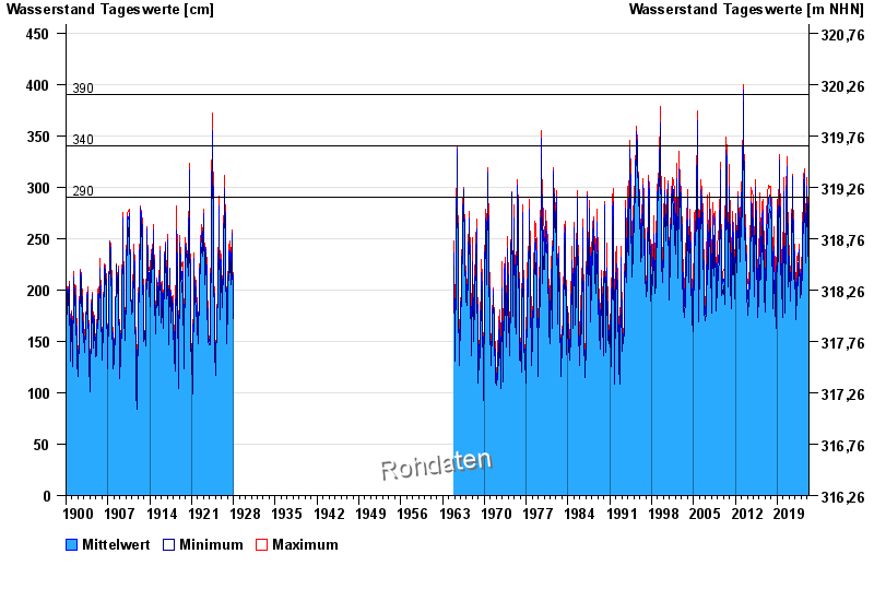
- 290 cm: Plattling: Überflutung der Vorländer beginnt
- 340 cm: Plattling: Entscheidung über den Aufruf der Deichwehren
| Date | Mean value [cm] | Maximum [cm] | Minimum [cm] |
|---|---|---|---|
| 30.04.2024 | 205 | 209 | 199 |
| 29.04.2024 | 198 | 210 | 185 |
| 28.04.2024 | 192 | 203 | 184 |
| 27.04.2024 | 188 | 197 | 184 |
| 26.04.2024 | 192 | 203 | 185 |
| 25.04.2024 | 199 | 205 | 193 |
| 24.04.2024 | 203 | 207 | 197 |
© Bayerisches Landesamt für Umwelt 2024