
- Start >
- Rivers >
- Waterlevel >
- Unterer Main >
- Mittelsinn >
- Current values

Current values Mittelsinn / Sinn
Waterlevel from 30.06.2021 to 07.07.2021
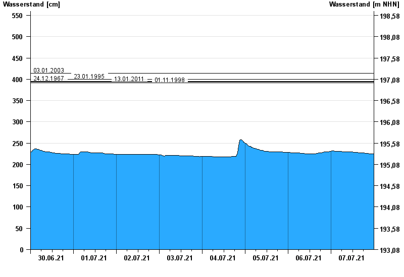
- 03.01.2003 Wasserstand: 414 cm
- 23.01.1995 Wasserstand: 400 cm
- 24.12.1967 Wasserstand: 395 cm
- 13.01.2011 Wasserstand: 394 cm
- 01.11.1998 Wasserstand: 392 cm
| Date | Waterlevel [cm] |
|---|---|
| 08.07.2021 00:45 | 225 |
| 08.07.2021 00:30 | 225 |
| 08.07.2021 00:15 | 225 |
| 08.07.2021 00:00 | 225 |
| 07.07.2021 23:45 | 225 |
| 07.07.2021 23:30 | 225 |
| 07.07.2021 23:15 | 225 |
© Bayerisches Landesamt für Umwelt 2024