
- Start >
- Rivers >
- Waterlevel >
- Unterer Main >
- Mittelsinn >
- Current values

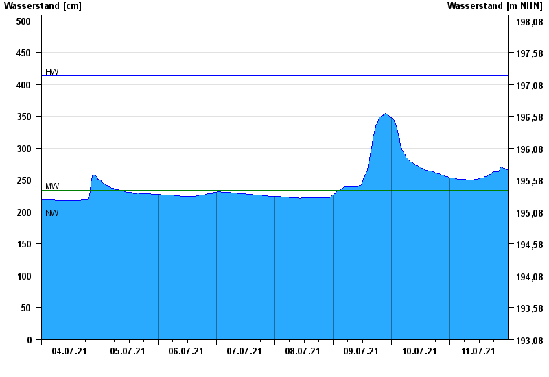
Current values Mittelsinn / Sinn
Waterlevel from 04.07.2021 to 11.07.2021
| Date | Waterlevel [cm] |
|---|---|
| 12.07.2021 00:45 | 265 |
| 12.07.2021 00:30 | 265 |
| 12.07.2021 00:15 | 265 |
| 12.07.2021 00:00 | 266 |
| 11.07.2021 23:45 | 267 |
| 11.07.2021 23:30 | 267 |
| 11.07.2021 23:15 | 268 |
© Bayerisches Landesamt für Umwelt 2024