
- Start >
- Rivers >
- Waterlevel >
- Unterer Main >
- Lohr >
- Chart of year

Chart of year Lohr / Baunach
Waterlevel from 28.02.2020 to 27.02.2021
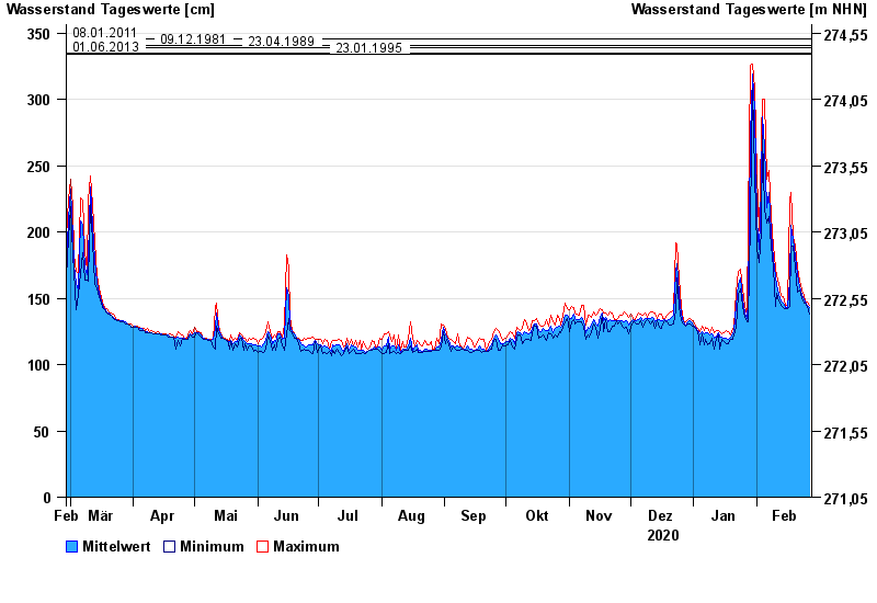
- 08.01.2011 Wasserstand: 346 cm
- 09.12.1981 Wasserstand: 341 cm
- 23.04.1989 Wasserstand: 339 cm
- 01.06.2013 Wasserstand: 335 cm
- 23.01.1995 Wasserstand: 334 cm
| Date | Mean value [cm] | Maximum [cm] | Minimum [cm] |
|---|---|---|---|
| 27.02.2021 | 143 | 145 | 138 |
| 26.02.2021 | 145 | 147 | 144 |
| 25.02.2021 | 147 | 148 | 146 |
| 24.02.2021 | 149 | 152 | 146 |
| 23.02.2021 | 153 | 156 | 150 |
| 22.02.2021 | 159 | 163 | 156 |
| 21.02.2021 | 168 | 174 | 155 |
© Bayerisches Landesamt für Umwelt 2024