
- Start >
- Rivers >
- Waterlevel >
- Unterer Main >
- Lohr >
- Chart of month

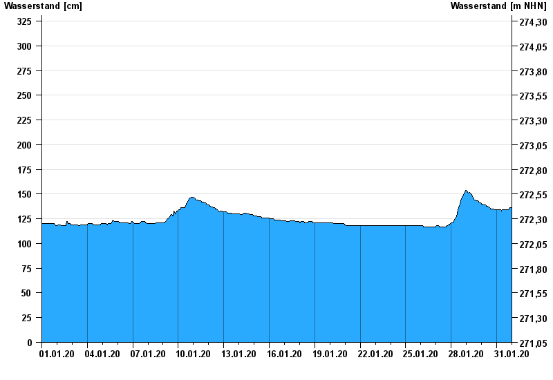
Chart of month Lohr / Baunach
Waterlevel from 01.01.2020 to 31.01.2020
- 08.01.2011 Wasserstand: 346 cm
- 09.12.1981 Wasserstand: 341 cm
- 23.04.1989 Wasserstand: 339 cm
- 01.06.2013 Wasserstand: 335 cm
- 23.01.1995 Wasserstand: 334 cm
| Date | Waterlevel [cm] |
|---|---|
| 31.01.2020 23:45 | 135 |
| 31.01.2020 23:30 | 136 |
| 31.01.2020 23:15 | 136 |
| 31.01.2020 23:00 | 136 |
| 31.01.2020 22:45 | 136 |
| 31.01.2020 22:30 | 136 |
| 31.01.2020 22:15 | 136 |
© Bayerisches Landesamt für Umwelt 2024