
- Start >
- Rivers >
- Waterlevel >
- Unterer Main >
- Leucherhof >
- Chart of year

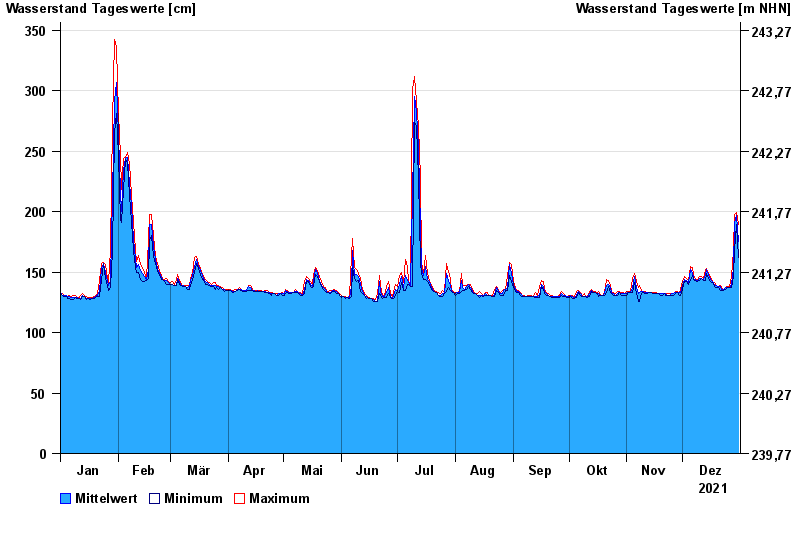
Chart of year Leucherhof / Baunach
Waterlevel from 01.01.2021 to 31.12.2021
- 07.05.1969 Wasserstand: 391 cm
- 23.02.1970 Wasserstand: 378 cm
- 03.01.2003 Wasserstand: 369 cm
- 08.01.2011 Wasserstand: 367 cm
- 23.01.1995 Wasserstand: 366 cm
| Date | Mean value [cm] | Maximum [cm] | Minimum [cm] |
|---|---|---|---|
| 31.12.2021 | 175 | 189 | 162 |
| 30.12.2021 | 197 | 199 | 189 |
| 29.12.2021 | 190 | 198 | 168 |
| 28.12.2021 | 153 | 168 | 146 |
| 27.12.2021 | 140 | 146 | 137 |
| 26.12.2021 | 137 | 138 | 137 |
| 25.12.2021 | 137 | 138 | 137 |
© Bayerisches Landesamt für Umwelt 2024