
- Start >
- Rivers >
- Waterlevel >
- Unterer Main >
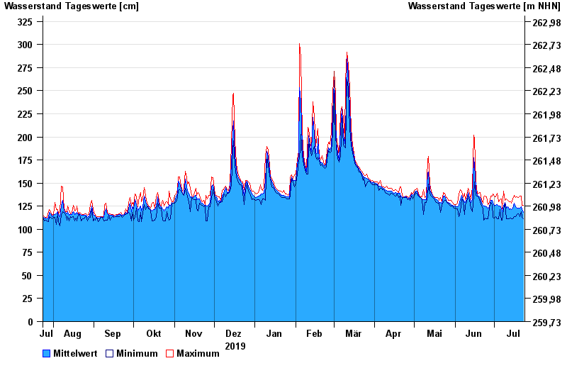
- Heinersdorf >
- Chart of year

Chart of year Heinersdorf / Rodach
Waterlevel from 24.07.2019 to 23.07.2020
- 03.01.2003 Wasserstand: 426 cm
- 08.05.2004 Wasserstand: 413 cm
- 14.01.2011 Wasserstand: 412 cm
- 24.12.1967 Wasserstand: 409 cm
- 23.02.1970 Wasserstand: 401 cm
| Date | Mean value [cm] | Maximum [cm] | Minimum [cm] |
|---|---|---|---|
| 23.07.2020 | 118 | 126 | 111 |
| 22.07.2020 | 121 | 126 | 113 |
| 21.07.2020 | 124 | 136 | 119 |
| 20.07.2020 | 123 | 136 | 114 |
| 19.07.2020 | 123 | 134 | 117 |
| 18.07.2020 | 123 | 135 | 116 |
| 17.07.2020 | 124 | 134 | 114 |
© Bayerisches Landesamt für Umwelt 2024