
- Start >
- Rivers >
- Waterlevel >
- Unterer Main >
- Heinersdorf >
- Chart of year

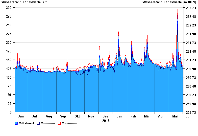
Chart of year Heinersdorf / Rodach
Waterlevel from 03.06.2018 to 02.06.2019
- 03.01.2003 Wasserstand: 426 cm
- 08.05.2004 Wasserstand: 413 cm
- 14.01.2011 Wasserstand: 412 cm
- 24.12.1967 Wasserstand: 409 cm
- 23.02.1970 Wasserstand: 401 cm
| Date | Mean value [cm] | Maximum [cm] | Minimum [cm] |
|---|---|---|---|
| 02.06.2019 | 128 | 131 | 125 |
| 01.06.2019 | 131 | 135 | 127 |
| 31.05.2019 | 132 | 136 | 127 |
| 30.05.2019 | 136 | 141 | 133 |
| 29.05.2019 | 145 | 156 | 136 |
| 28.05.2019 | 158 | 166 | 146 |
| 27.05.2019 | 146 | 148 | 140 |
© Bayerisches Landesamt für Umwelt 2024