
- Start >
- Rivers >
- Waterlevel >
- Unterer Main >
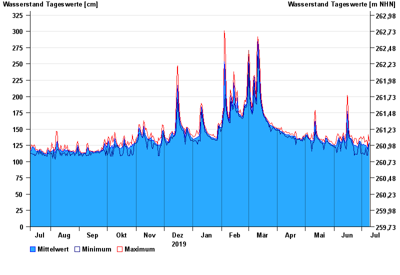
- Heinersdorf >
- Chart of year

Chart of year Heinersdorf / Rodach
Waterlevel from 10.07.2019 to 09.07.2020
- 03.01.2003 Wasserstand: 426 cm
- 08.05.2004 Wasserstand: 413 cm
- 14.01.2011 Wasserstand: 412 cm
- 24.12.1967 Wasserstand: 409 cm
- 23.02.1970 Wasserstand: 401 cm
| Date | Mean value [cm] | Maximum [cm] | Minimum [cm] |
|---|---|---|---|
| 09.07.2020 | 129 | 131 | 128 |
| 08.07.2020 | 125 | 141 | 121 |
| 07.07.2020 | 119 | 122 | 110 |
| 06.07.2020 | 122 | 133 | 110 |
| 05.07.2020 | 125 | 132 | 121 |
| 04.07.2020 | 125 | 130 | 111 |
| 03.07.2020 | 127 | 139 | 111 |
© Bayerisches Landesamt für Umwelt 2024