
- Start >
- Rivers >
- Waterlevel >
- Unterer Main >
- Heinersdorf >
- Chart of year

Chart of year Heinersdorf / Rodach
Waterlevel from 03.03.2021 to 02.03.2022
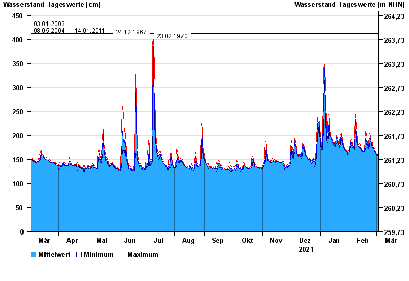
- 03.01.2003 Wasserstand: 426 cm
- 08.05.2004 Wasserstand: 413 cm
- 14.01.2011 Wasserstand: 412 cm
- 24.12.1967 Wasserstand: 409 cm
- 23.02.1970 Wasserstand: 401 cm
| Date | Mean value [cm] | Maximum [cm] | Minimum [cm] |
|---|---|---|---|
| 02.03.2022 | 161 | 162 | 158 |
| 01.03.2022 | 162 | 164 | 161 |
| 28.02.2022 | 165 | 166 | 163 |
| 27.02.2022 | 167 | 170 | 165 |
| 26.02.2022 | 172 | 175 | 170 |
| 25.02.2022 | 176 | 178 | 174 |
| 24.02.2022 | 181 | 189 | 176 |
© Bayerisches Landesamt für Umwelt 2024