
- Start >
- Rivers >
- Waterlevel >
- Unterer Main >
- Hafenlohr >
- Chart of month

Chart of month Hafenlohr / Hafenlohr
Waterlevel from 29.03.2024 to 28.04.2024
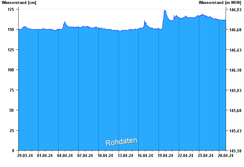
- Hochwassergefahrenfläche HQ100 330 cm
| Date | Waterlevel [cm] |
|---|---|
| 27.04.2024 09:15 | 163 |
| 27.04.2024 09:00 | 163 |
| 27.04.2024 08:45 | 163 |
| 27.04.2024 08:30 | 164 |
| 27.04.2024 08:15 | 163 |
| 27.04.2024 08:00 | 162 |
| 27.04.2024 07:45 | 163 |
© Bayerisches Landesamt für Umwelt 2024