
- Start >
- Rivers >
- Waterlevel >
- Unterer Main >
- Gräfendorf >
- Chart of year

Chart of year Gräfendorf / Schondra
Waterlevel from 28.04.2024 to 27.04.2025
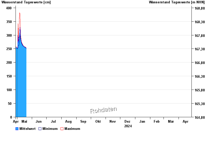
| Date | Mean value [cm] | Maximum [cm] | Minimum [cm] |
|---|---|---|---|
| 09.05.2024 | 285 | 285 | 284 |
| 08.05.2024 | 292 | 302 | 286 |
| 07.05.2024 | 329 | 379 | 302 |
| 06.05.2024 | 301 | 382 | 280 |
| 05.05.2024 | 290 | 326 | 263 |
| 04.05.2024 | 270 | 279 | 264 |
| 03.05.2024 | 300 | 342 | 256 |
© Bayerisches Landesamt für Umwelt 2024