
- Start >
- Rivers >
- Waterlevel >
- Unterer Main >
- Gräfendorf >
- Chart of year

Chart of year Gräfendorf / Schondra
Waterlevel from 26.01.2022 to 25.01.2023
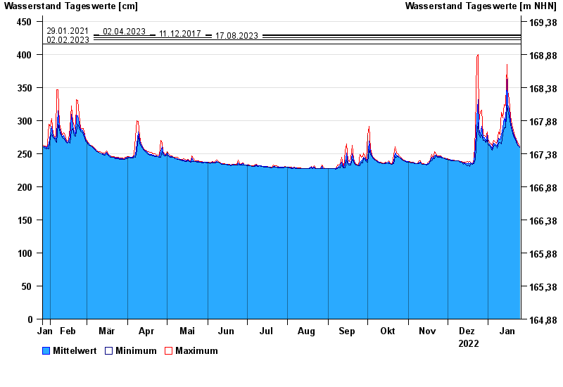
- 29.01.2021 Wasserstand: 430 cm
- 02.04.2023 Wasserstand: 428 cm
- 11.12.2017 Wasserstand: 425 cm
- 17.08.2023 Wasserstand: 422 cm
- 02.02.2023 Wasserstand: 416 cm
| Date | Mean value [cm] | Maximum [cm] | Minimum [cm] |
|---|---|---|---|
| 25.01.2023 | 260 | 261 | 259 |
| 24.01.2023 | 262 | 265 | 261 |
| 23.01.2023 | 266 | 269 | 265 |
| 22.01.2023 | 270 | 272 | 268 |
| 21.01.2023 | 274 | 277 | 272 |
| 20.01.2023 | 281 | 285 | 277 |
| 19.01.2023 | 288 | 294 | 285 |
© Bayerisches Landesamt für Umwelt 2024