
- Start >
- Rivers >
- Waterlevel >
- Unterer Main >
- Gräfendorf >
- Chart of year

Chart of year Gräfendorf / Schondra
Waterlevel from 01.01.2023 to 31.12.2023
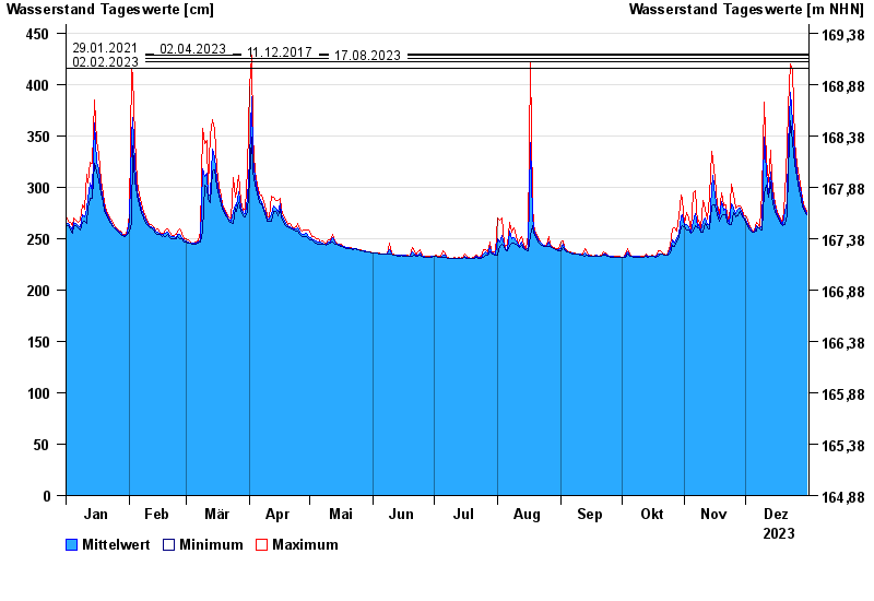
- 29.01.2021 Wasserstand: 430 cm
- 02.04.2023 Wasserstand: 428 cm
- 11.12.2017 Wasserstand: 425 cm
- 17.08.2023 Wasserstand: 422 cm
- 02.02.2023 Wasserstand: 416 cm
| Date | Mean value [cm] | Maximum [cm] | Minimum [cm] |
|---|---|---|---|
| 31.12.2023 | 274 | 276 | 273 |
| 30.12.2023 | 279 | 281 | 276 |
| 29.12.2023 | 285 | 288 | 281 |
| 28.12.2023 | 293 | 298 | 288 |
| 27.12.2023 | 302 | 309 | 298 |
| 26.12.2023 | 316 | 322 | 309 |
| 25.12.2023 | 332 | 344 | 322 |
© Bayerisches Landesamt für Umwelt 2024