
- Start >
- Rivers >
- Waterlevel >
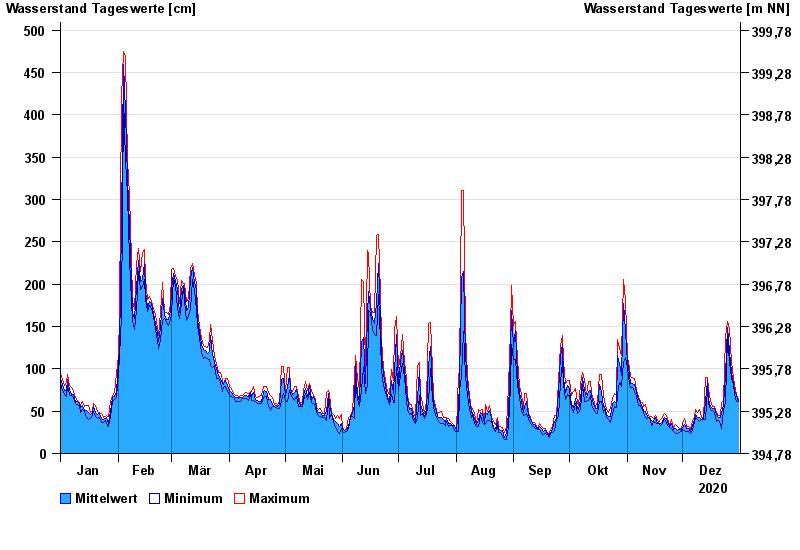
- Unterer Main >
- Donauwörth >
- Chart of year

Chart of year Donauwörth / Donau
Waterlevel from 01.01.2020 to 31.12.2020
- 14.04.1994 Wasserstand: 577 cm
- 16.02.1990 Wasserstand: 553 cm
- 24.05.1999 Wasserstand: 552 cm
- 27.03.1988 Wasserstand: 544 cm
- 01.02.1982 Wasserstand: 543 cm
| Date | Mean value [cm] | Maximum [cm] | Minimum [cm] |
|---|---|---|---|
| 31.12.2020 | 62 | 64 | 61 |
| 30.12.2020 | 68 | 70 | 61 |
| 29.12.2020 | 75 | 81 | 70 |
| 28.12.2020 | 83 | 88 | 81 |
| 27.12.2020 | 96 | 108 | 88 |
| 26.12.2020 | 120 | 148 | 108 |
| 25.12.2020 | 149 | 156 | 138 |
© Bayerisches Landesamt für Umwelt 2024