
- Start >
- Rivers >
- Waterlevel >
- Unterer Main >
- Bürgstadt >
- Chart of month

Chart of month Bürgstadt / Erf
Waterlevel from 01.08.2020 to 31.08.2020
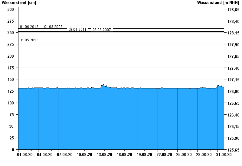
- 01.06.2013 Wasserstand: 259 cm
- 01.03.2008 Wasserstand: 259 cm
- 08.01.2011 Wasserstand: 253 cm
- 08.08.2007 Wasserstand: 252 cm
- 31.05.2013 Wasserstand: 230 cm
| Date | Waterlevel [cm] |
|---|---|
| 01.09.2020 00:45 | 133 |
| 01.09.2020 00:30 | 133 |
| 01.09.2020 00:15 | 133 |
| 01.09.2020 00:00 | 133 |
| 31.08.2020 23:45 | 133 |
| 31.08.2020 23:30 | 133 |
| 31.08.2020 23:15 | 133 |
© Bayerisches Landesamt für Umwelt 2024