
- Start >
- Rivers >
- Waterlevel >
- Unterer Main >
- Bad Königshofen im Grabfeld >
- Chart of year

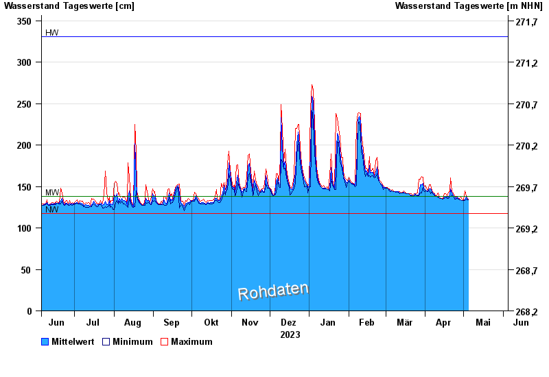
Chart of year Bad Königshofen im Grabfeld / Fränkische Saale
Waterlevel from 05.06.2023 to 04.06.2024
note
Biberaktivität: Werte können durch Aufstau beeinflusst sein
| Date | Mean value [cm] | Maximum [cm] | Minimum [cm] |
|---|---|---|---|
| 05.05.2024 | 135 | 136 | 134 |
| 04.05.2024 | 134 | 135 | 134 |
| 03.05.2024 | 137 | 139 | 135 |
| 02.05.2024 | 135 | 145 | 133 |
| 01.05.2024 | 133 | 134 | 133 |
| 30.04.2024 | 133 | 135 | 133 |
| 29.04.2024 | 134 | 137 | 134 |
© Bayerisches Landesamt für Umwelt 2024