
- Start >
- Rivers >
- Waterlevel >
- Unterer Main >
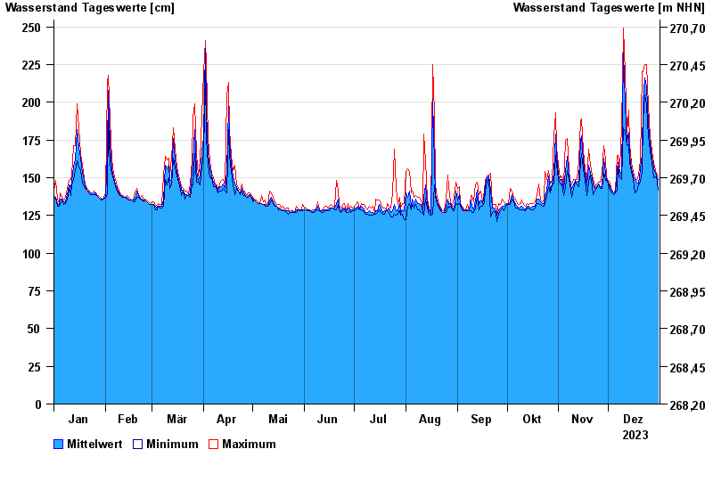
- Bad Königshofen im Grabfeld >
- Chart of year

Chart of year Bad Königshofen im Grabfeld / Fränkische Saale
Waterlevel from 01.01.2023 to 31.12.2023
note
Biberaktivität: Werte können durch Aufstau beeinflusst sein
- 03.01.2003 Wasserstand: 331 cm
- 23.02.1970 Wasserstand: 313 cm
- 09.12.1981 Wasserstand: 312 cm
- 08.01.2011 Wasserstand: 308 cm
- 23.04.1989 Wasserstand: 301 cm
| Date | Mean value [cm] | Maximum [cm] | Minimum [cm] |
|---|---|---|---|
| 31.12.2023 | 149 | 151 | 142 |
| 30.12.2023 | 152 | 153 | 151 |
| 29.12.2023 | 154 | 157 | 150 |
| 28.12.2023 | 157 | 160 | 150 |
| 27.12.2023 | 163 | 168 | 160 |
| 26.12.2023 | 173 | 177 | 168 |
| 25.12.2023 | 186 | 198 | 177 |
© Bayerisches Landesamt für Umwelt 2024