
- Start >
- Rivers >
- Waterlevel >
- Unterer Main >
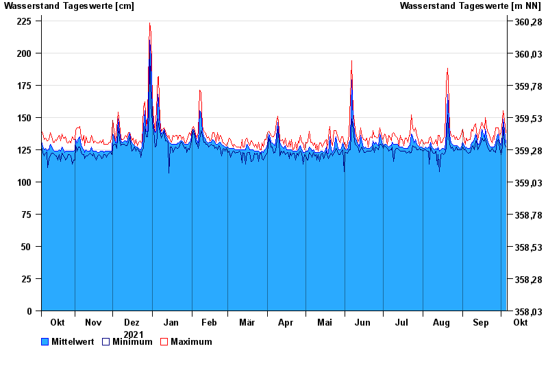
- Aunkofen >
- Chart of year

Chart of year Aunkofen / Abens
Waterlevel from 06.10.2021 to 05.10.2022
- 03.06.2013 Wasserstand: 351 cm
- 13.04.1994 Wasserstand: 340 cm
- 16.02.1990 Wasserstand: 338 cm
- 02.08.1991 Wasserstand: 337 cm
- 21.03.2002 Wasserstand: 328 cm
| Date | Mean value [cm] | Maximum [cm] | Minimum [cm] |
|---|---|---|---|
| 05.10.2022 | 130 | 138 | 127 |
| 04.10.2022 | 140 | 148 | 129 |
| 03.10.2022 | 149 | 155 | 144 |
| 02.10.2022 | 136 | 148 | 127 |
| 01.10.2022 | 128 | 138 | 121 |
| 30.09.2022 | 131 | 136 | 126 |
| 29.09.2022 | 137 | 142 | 133 |
© Bayerisches Landesamt für Umwelt 2024