
- Start >
- Rivers >
- Waterlevel >
- Unterer Main >
- Astheim >
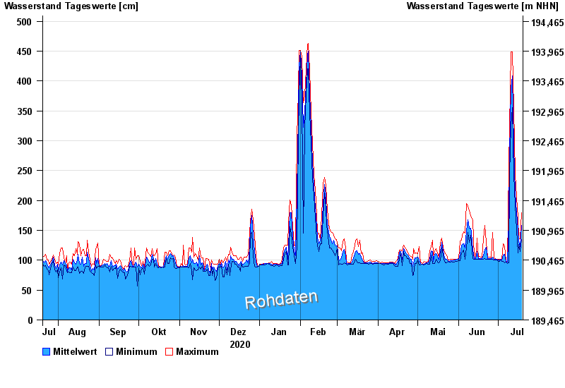
- Chart of year

Chart of year Astheim / Main
Waterlevel from 20.07.2020 to 19.07.2021
- 16.01.2011 Wasserstand: 665 cm
- 05.01.2003 Wasserstand: 663 cm
- 25.02.1970 Wasserstand: 627 cm
- 08.01.1982 Wasserstand: 624 cm
- 28.01.1995 Wasserstand: 623 cm
| Date | Mean value [cm] | Maximum [cm] | Minimum [cm] |
|---|---|---|---|
| 19.07.2021 | 158 | 179 | 135 |
| 18.07.2021 | 123 | 136 | 115 |
| 17.07.2021 | 131 | 137 | 126 |
| 16.07.2021 | 151 | 171 | 112 |
| 15.07.2021 | 181 | 205 | 151 |
| 14.07.2021 | 213 | 244 | 192 |
| 13.07.2021 | 291 | 356 | 243 |
© Bayerisches Landesamt für Umwelt 2024