
- Start >
- Rivers >
- Waterlevel >
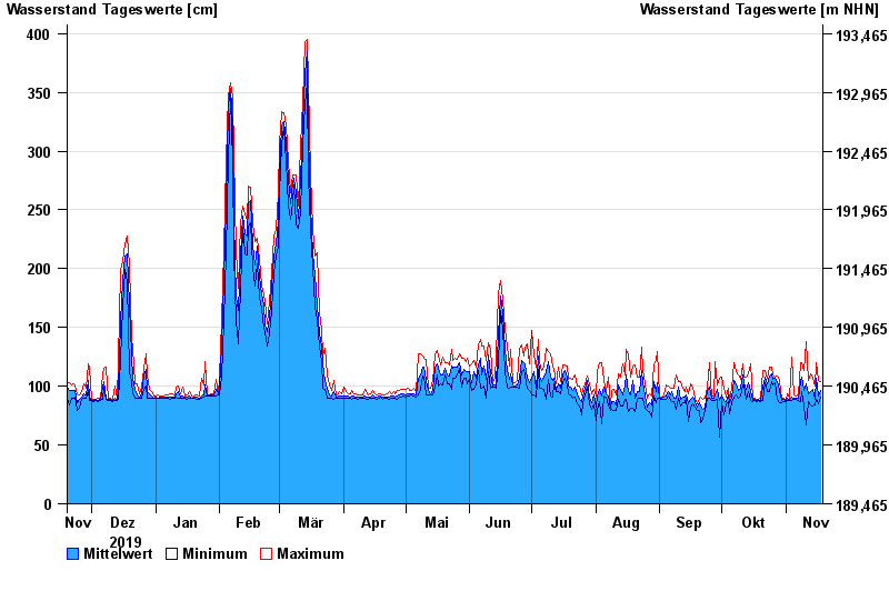
- Unterer Main >
- Astheim >
- Chart of year

Chart of year Astheim / Main
Waterlevel from 19.11.2019 to 18.11.2020
- 16.01.2011 Wasserstand: 665 cm
- 05.01.2003 Wasserstand: 663 cm
- 25.02.1970 Wasserstand: 627 cm
- 08.01.1982 Wasserstand: 624 cm
- 28.01.1995 Wasserstand: 623 cm
| Date | Mean value [cm] | Maximum [cm] | Minimum [cm] |
|---|---|---|---|
| 18.11.2020 | 96 | 104 | 91 |
| 17.11.2020 | 92 | 105 | 85 |
| 16.11.2020 | 107 | 120 | 89 |
| 15.11.2020 | 89 | 100 | 84 |
| 14.11.2020 | 97 | 107 | 83 |
| 13.11.2020 | 95 | 111 | 84 |
| 12.11.2020 | 94 | 105 | 87 |
© Bayerisches Landesamt für Umwelt 2024