
- Start >
- Rivers >
- Waterlevel >
- Unterer Main >
- Astheim >
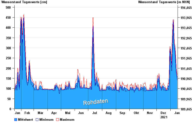
- Chart of year

Chart of year Astheim / Main
Waterlevel from 17.01.2021 to 16.01.2022
- 16.01.2011 Wasserstand: 665 cm
- 05.01.2003 Wasserstand: 663 cm
- 25.02.1970 Wasserstand: 627 cm
- 08.01.1982 Wasserstand: 624 cm
- 28.01.1995 Wasserstand: 623 cm
| Date | Mean value [cm] | Maximum [cm] | Minimum [cm] |
|---|---|---|---|
| 16.01.2022 | 157 | 169 | 142 |
| 15.01.2022 | 168 | 178 | 158 |
| 14.01.2022 | 189 | 201 | 173 |
| 13.01.2022 | 215 | 237 | 185 |
| 12.01.2022 | 256 | 276 | 238 |
| 11.01.2022 | 296 | 311 | 270 |
| 10.01.2022 | 308 | 314 | 296 |
© Bayerisches Landesamt für Umwelt 2024