
- Start >
- Rivers >
- Waterlevel >
- Unterer Main >
- Astheim >
- Chart of year

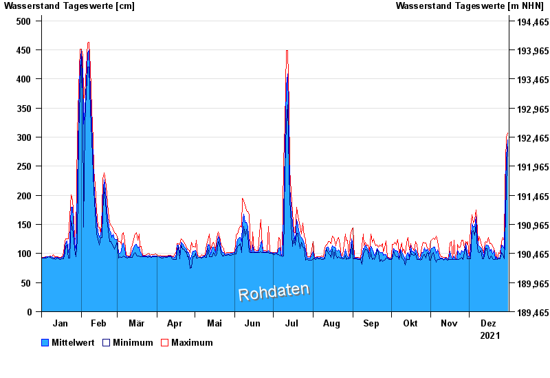
Chart of year Astheim / Main
Waterlevel from 01.01.2021 to 31.12.2021
- 16.01.2011 Wasserstand: 665 cm
- 05.01.2003 Wasserstand: 663 cm
- 25.02.1970 Wasserstand: 627 cm
- 08.01.1982 Wasserstand: 624 cm
- 28.01.1995 Wasserstand: 623 cm
| Date | Mean value [cm] | Maximum [cm] | Minimum [cm] |
|---|---|---|---|
| 31.12.2021 | 295 | 307 | 283 |
| 30.12.2021 | 268 | 300 | 216 |
| 29.12.2021 | 167 | 215 | 120 |
| 28.12.2021 | 108 | 122 | 91 |
| 27.12.2021 | 113 | 128 | 98 |
| 26.12.2021 | 115 | 120 | 101 |
| 25.12.2021 | 92 | 100 | 91 |
© Bayerisches Landesamt für Umwelt 2024