
- Start >
- Rivers >
- Waterlevel >
- Unterer Main >
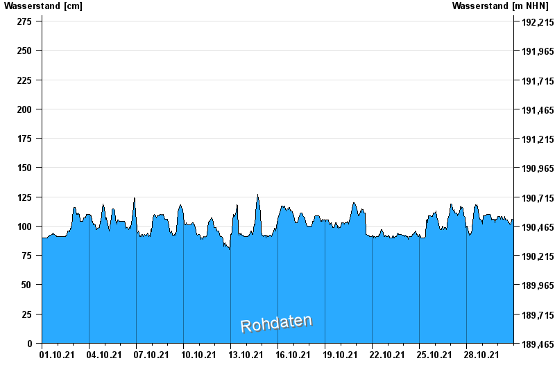
- Astheim >
- Chart of month

Chart of month Astheim / Main
Waterlevel from 01.10.2021 to 30.10.2021
- 16.01.2011 Wasserstand: 665 cm
- 05.01.2003 Wasserstand: 663 cm
- 25.02.1970 Wasserstand: 627 cm
- 08.01.1982 Wasserstand: 624 cm
- 28.01.1995 Wasserstand: 623 cm
| Date | Waterlevel [cm] |
|---|---|
| 31.10.2021 00:45 | 104 |
| 31.10.2021 00:30 | 104 |
| 31.10.2021 00:15 | 106 |
| 31.10.2021 00:00 | 106 |
| 30.10.2021 23:45 | 106 |
| 30.10.2021 23:30 | 104 |
| 30.10.2021 23:15 | 104 |
© Bayerisches Landesamt für Umwelt 2024