
- Start >
- Rivers >
- Waterlevel >
- Unterer Main >
- Alzenau >
- Chart of month

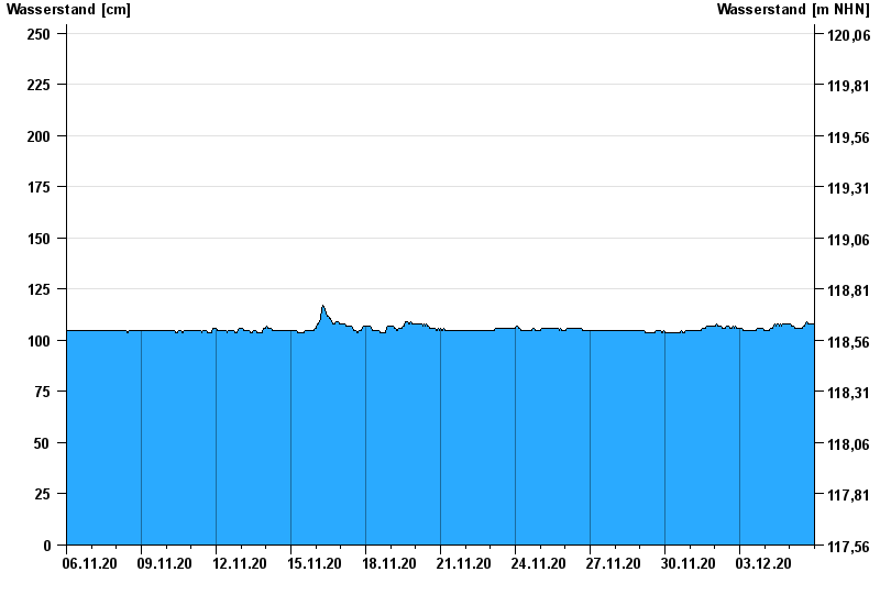
Chart of month Alzenau / Kahl
Waterlevel from 06.11.2020 to 05.12.2020
- 04.05.2017 Wasserstand: 298 cm
- 13.02.2002 Wasserstand: 295 cm
- 03.01.2003 Wasserstand: 280 cm
- 26.01.1995 Wasserstand: 277 cm
- 29.10.1998 Wasserstand: 275 cm
| Date | Waterlevel [cm] |
|---|---|
| 05.12.2020 23:45 | 108 |
| 05.12.2020 23:30 | 108 |
| 05.12.2020 23:15 | 108 |
| 05.12.2020 23:00 | 108 |
| 05.12.2020 22:45 | 108 |
| 05.12.2020 22:30 | 108 |
| 05.12.2020 22:15 | 108 |
© Bayerisches Landesamt für Umwelt 2024