
- Start >
- Rivers >
- Waterlevel >
- Obere Donau >
- Zaisertshofen >
- Chart of month

Chart of month Zaisertshofen / Flossach
Waterlevel from 01.04.2022 to 30.04.2022
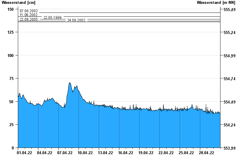
- 07.06.2002 Wasserstand: 146 cm
- 11.08.2002 Wasserstand: 142 cm
- 22.05.1999 Wasserstand: 139 cm
- 22.08.2005 Wasserstand: 137 cm
- 24.09.2002 Wasserstand: 136 cm
| Date | Waterlevel [cm] |
|---|---|
| 01.05.2022 00:45 | 36 |
| 01.05.2022 00:30 | 36 |
| 01.05.2022 00:15 | 35 |
| 01.05.2022 00:00 | 35 |
| 30.04.2022 23:45 | 37 |
| 30.04.2022 23:30 | 37 |
| 30.04.2022 23:15 | 37 |
© Bayerisches Landesamt für Umwelt 2024